September marks the end of our first Associates program. Our lab enjoyed learning and working with several graduate students on projects with community members and elected officials. Associates joined the lab to gain exposure to civic tech work, supporting our Research and Data Assistance (RADAR) service. RADAR is a way for any NYC community member or stakeholder to leverage BetaNYC’s knowledge and talent to address urban data challenges and needs.
It was a privilege to have Eva, HaoChe and Ziqi in our office this summer. Read on for a summary of some of the exemplary work they did, including: researching and improving the user-experience of a popular BetaNYC tool, developing a spatial analysis tool to quantify patterns and relationships in council district-level open data, and designing a dashboard for community members to make sense of complicated environmental data.
Revamping Boundaries Map
Boundaries Map was created in 2018 using Carto and Leaflet. It aimed to respond to an outstanding need for NYC stakeholders to understand where common political and administrative boundaries overlap. It helps answer questions like “what community boards are in this council district?”. Over the years we have added features and addressed issues, but in small ways. This summer, Eva took charge to completely revamp how users experience the tool.
With the option to display 14 different layers on a single map, it was difficult to quickly see where boundaries intersected in one district. Eva conducted research on how users currently use the tool and designed a cleaner interface to weed out the noise. Her goals were to focus on 1) viewing all layers that intersect with one district and 2) displaying each overlap so it’s quick and easy, and not overwhelming, to view where things intersect.
Technically, we transitioned the frontend from CartoDB to Mapbox, while still maintaining CartoDB as the backend. As well as updating the interface, we corrected for a ton of bugs in querying for districts that had invalid geometries and updated newly redistricted boundaries.
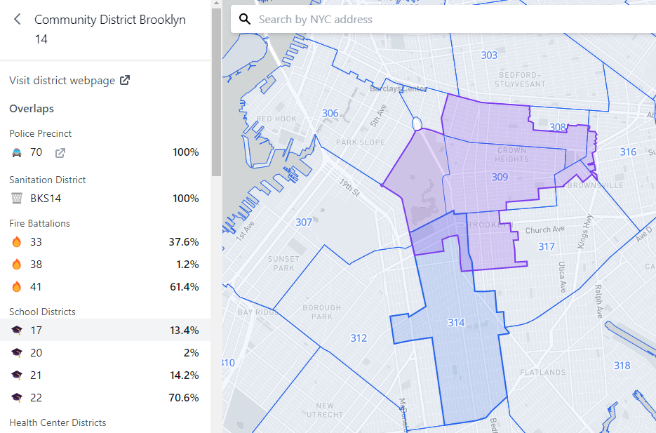
Check out the newly updated Boundaries Map here. It includes a reworked UI and overlaps details with percentages. As well as a ton of bug fixes! ??
A tool for analyzing neighborhood and street-level trends in Film Permits data.
The Film and Television industry plays an big economic role in NYC, however, many community members find their lives disrupted when film shoots take over public street space. Over the years, City Council Members have introduced laws seeking to reduce this disruption, such as requiring crews to provide advance notice of upcoming film shoots to the public. This Summer, BetaNYC responded to an inquiry from a Council Member, whose district sees a lot of film permit activity, to better understand which neighborhoods and streets are blocked the most their.
Learn more about the project, spearheaded by Hao Che, in this blog post that documents our methodology and final outputs. Want to learn how often your street is blocked by a film shoot? Explore film permit locations data on this interactive map we created with ArcGIS Online.
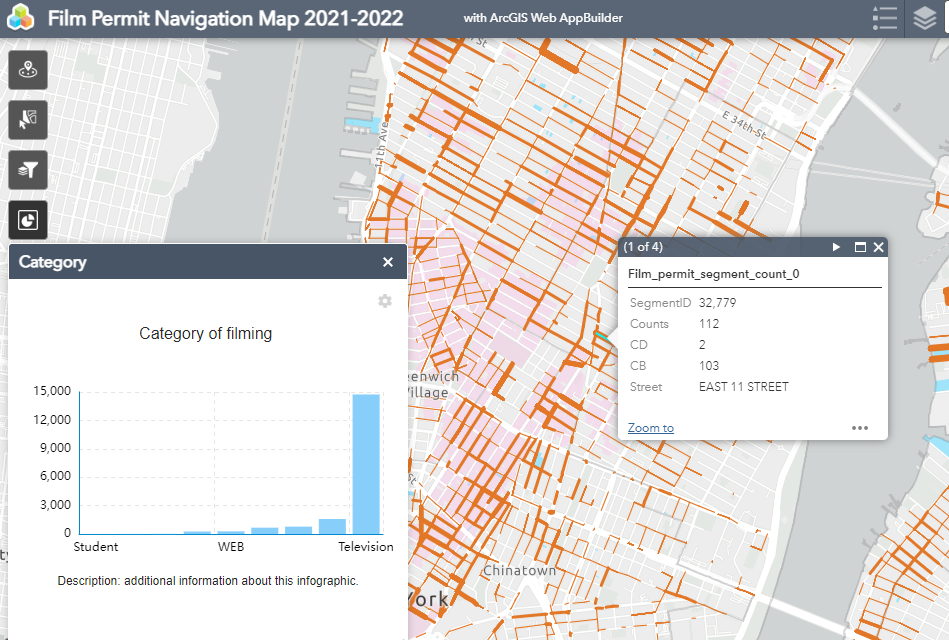
New York City Council’s data team also published an informative post in 2021 about the Film and Television permits in NYC!
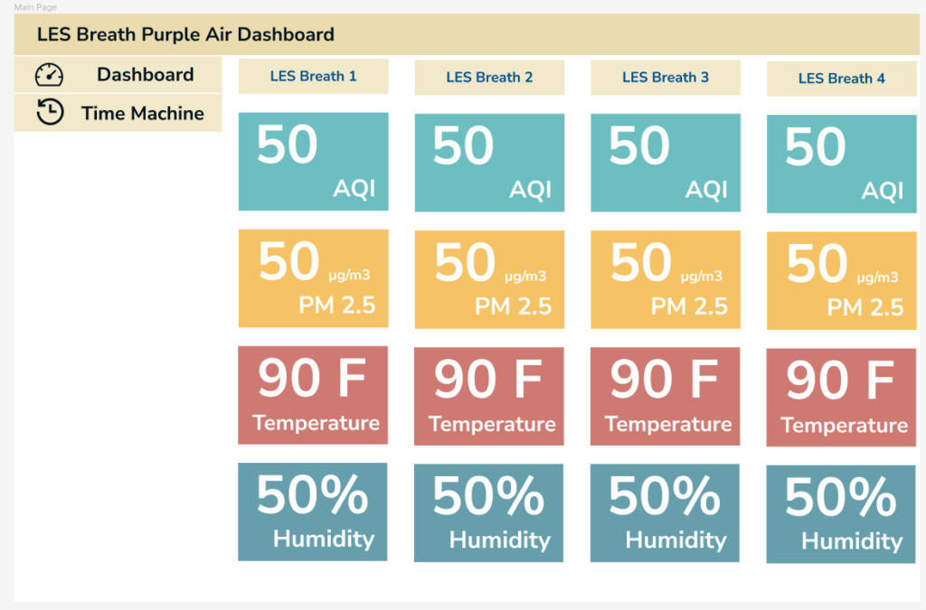
A dashboard to test a strategy for communicating Air Quality Data simply and effectively.
This project is ongoing! LES Breathe approached us to understand patterns and trends in air quality data they are collecting from four Purple Air monitors they set up in various locations on the Lower East Side and in Brooklyn. They were curious, how does the air compare today to this day last year? They asked us to help them figure out how to communicate such information since Purple Air’s interface required more digital literacy than many folks in the community have.
Ziqi worked hard to gain access to the data. She came upon a few discoveries that we hope to resolve soon with Purple Air, so that we can obtain on-going access to long-term data. BetaNYC hopes to release this tool soon. If you’re interested in this project, let us know!
Other Notable Work
- We published a story map on the history of the Neponsit Beach Hospital.
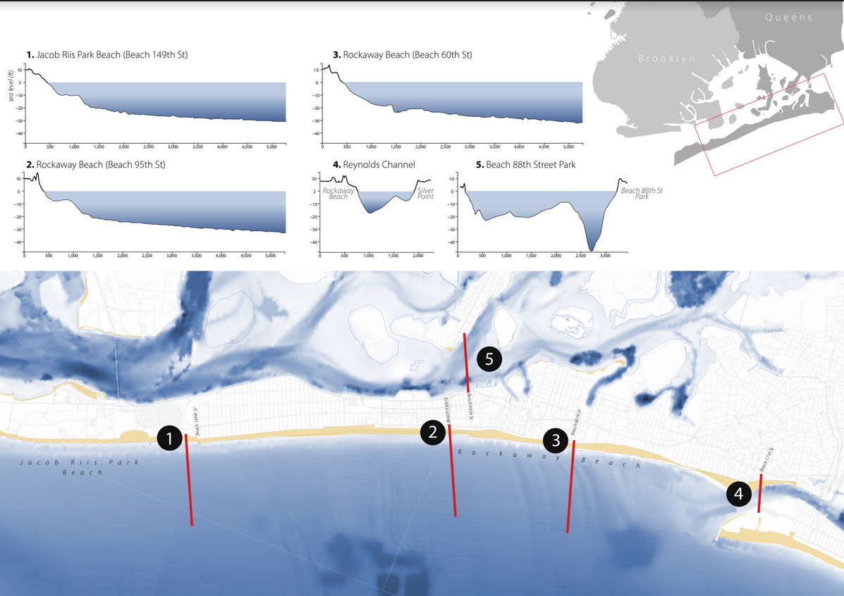
- Seafloor elevation around public areas in the Rockaways featured at Water Safety workshop hosted by the Rising Tide Effect.
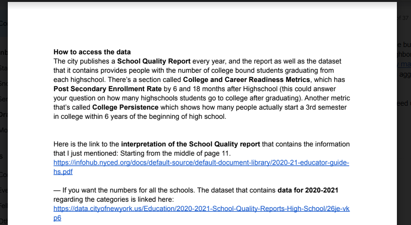
- We produced guides on accessing datasets including NYC School Budgets and performance.
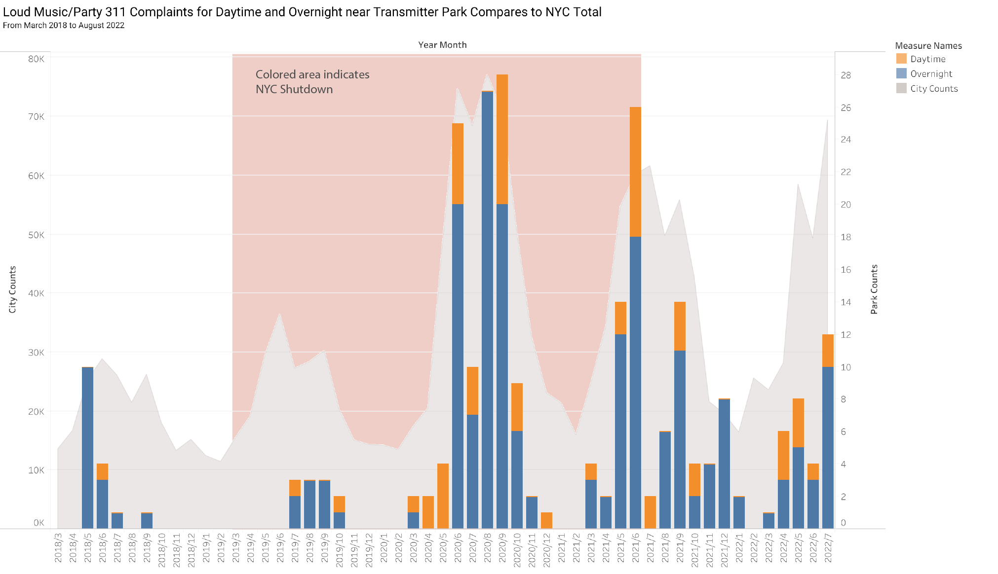
- We conducted an analysis on Noise Complaints around Transmitter Park in North Brooklyn
- We conducted an analysis on Open Streets and created survey visualizations.
Hats off to our Civic Innovation Lab and especially Eva, HaoChe, and Ziqi who spent their summer breaks with us. We look forward to all the wonderful projects and roles you lead into the future!