Context
In 2019, Hector Rivera, the MBPO’s Topographic Associate and BetaNYC started conversions on methods to help digitize his system of organizing address applications. The previous system used a series of folders with attachments of site plans, letters, and photos taken during site visits. This provided difficulty for the topo office to share the statuses of applications and search historical documents, when requested by the BP, office staff, and developers. In addition during site visits, photos taken to verify entrances/exits of buildings were hard to keep track of.
Outcome
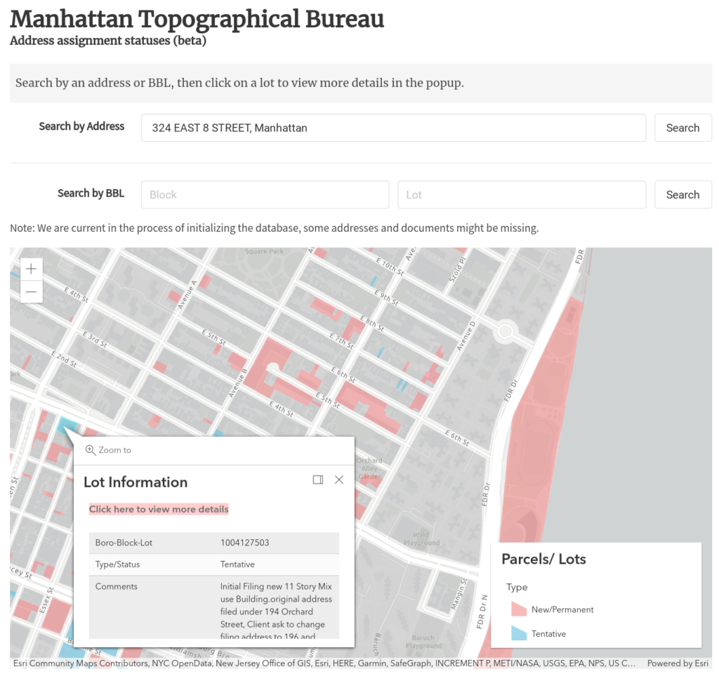
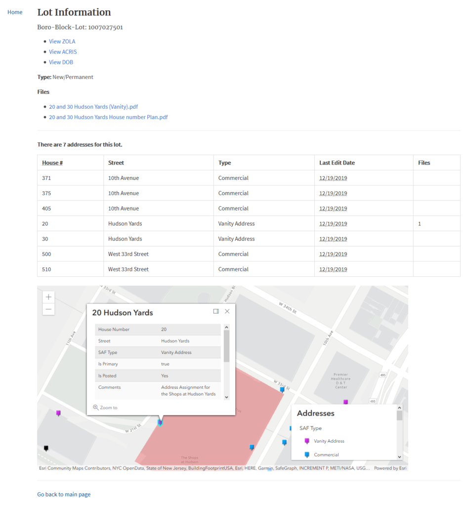
We built an initial prototype in the following month in ArcGIS Online to:
- Store all the information that was previously in the folders by tax lots (BBL) and address points in a geographic database
- Allow for tax lots to be updated with statuses and notes using a website
- Allow for updates and photos to be attached from a smartphone during site visits
- Create a searchable web map that allows office staff to check statuses and get documents (read-only)