BetaNYC’s Civic Innovation Lab supports the tech and data needs of New Yorkers in a few ways. We build a curriculum that empowers New Yorkers to harness Open Data.
We also build data-driven tools and resources that meet the needs of New Yorkers. We do this through a free, help-desk service called RADAR. Community organizations and elected officials are invited to use this service to request our support. We have completed over 400 RADARs to date!
Below is a listing of some of the past curriculum, tools and prototypes we have built and supported.
Report a Bug
Your feedback is welcome on BetaNYC’s digital tools. Please let us know if something isn’t quite working right with one of our tools.
To submit a bug ticket and provide feedback, fill out the form below
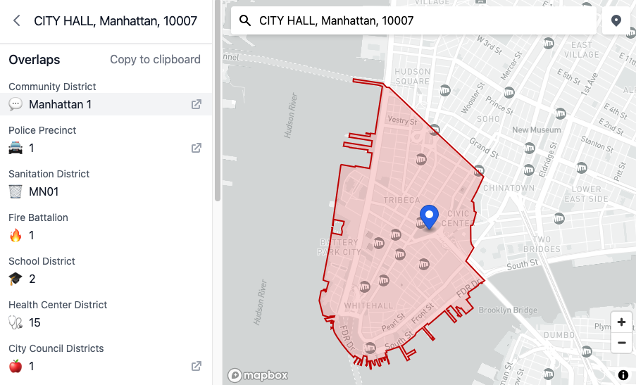
Boundaries Map
A helpful tool for viewing and querying overlapping administrative boundaries in New York City. Also helps to facilitate the work of government staff.
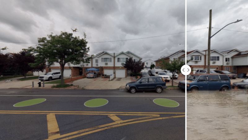
FloodGen
A flood advocacy tool employing generative AI to produce photorealistic visualizations of potential flood scenarios across New York City.
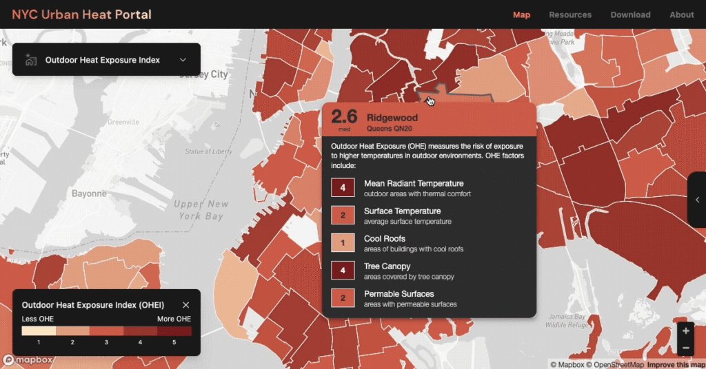
NYC Urban Heat Portal
A collaborative web platform that helps New York City residents explore urban heat data, visualize heat metrics across neighborhoods, and discover cooling strategies.
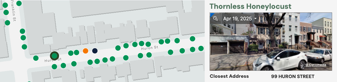
D33 Tree Stewardship Map
A neighborhood map for finding, adopting, and caring for the street trees of Brooklyn’s City Council District 33.
AI Tools for NYC’s Democracy
Six open-source tools that connect AI assistants to live NYC and New York State public data, so anyone can question the city in plain language.
Archived Projects
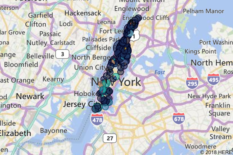
Batch Geocoder for NYC
A web tool for easy batch geocoding (latitude, longitude, & other geographic data from an address).
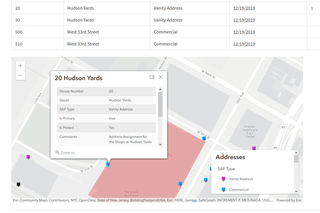
Topographic Address Assignment Database
A tool to manage and see address assignment statues for the Manhattan Topographical Bureau.
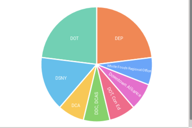
BoardStat
An interactive tool for community boards to analyze 311 data in NYC community districts.

BoardTrack
An attendance tracking tool and data standard that helps staff submit attendance records
Community Board Database
For Community Boards to organize administrative information and track their district’s responsibilities.
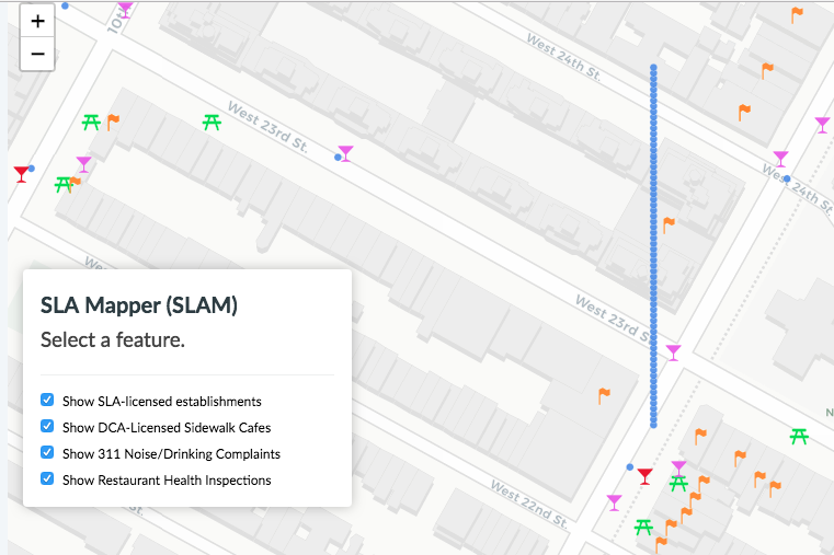
SLAM – State Liquor Authority Map
A tool to streamline community boards’s process of gathering information for liquor license and sidewalk cafe application reviews.
OpenStreetsNYC Toolkit
A tool to help community partners manage the logistics of volunteers, time, and communication, sponsored by Airtable’s COVID-19 relief program.
Tenants Map↗
TenantsMap displays rent-regulated buildings in Manhattan with housing-related 311 service requests to help community organizations, boards, and elected identify tenant harassment and displacement risks.
Community Data Portal↗
A community data portal for everyone to share their scraped data or learn about popular topics by exploring published datasets (This site is currently being upgraded)
CityGram.NYC↗
A notifications platform for subscribing to your city, whether it’s consumer complaints, 311 service requests, vehicle collisions, or restaurant inspections in your area.
After Hours Variance Dashboard↗
The AHV Dashboard is a tool to track the effect of after-hours variances in New York City community districts. The tool empowers community boards and district offices to advocate for better quality of life conditions in their districts.
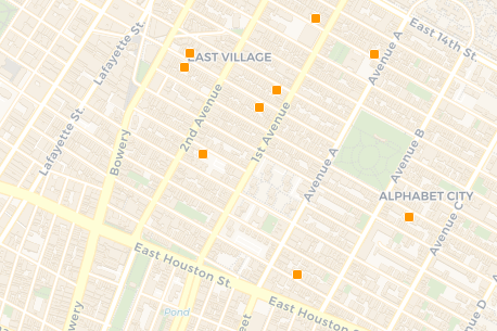
Internet Access Points/Wifi Hotspots↗
A web map that aggregates public, and private wireless internet access points. Displaying this information allows residents, and people without internet access to find the nearest locations to connect their devices to.
Community Board Votes↗
An Airtable template created with community boards to meet their bylaws around executive committee and resolutions elections during virtual meetings.