Context
Geocoding is the process of taking an address (1 Centre Street) or geographic context (Municipal Building) and returning geographic coordinates and other information. (40.712974, -74.003676, lot 121)
It has been as mostly inaccessible to non-technical users in NYC as the tools required downloading a application (GeoSupport), knowing how to use APIS or programming languages/ libraries, or one time request on websites (GOAT).
For technical users, [batch] geocoding large amount of address, verifying the quality of them, and correcting for errors is complex workflow. This may require error handling in scripts or correcting then re-running of the software over and over…
In 2019, the DCP’s Planning Labs team created NYC GeoSearch. (GeoClient API is a good alternative, with more advance functions) In addition a tool created by Erik Willems connect to similar API had a simple web tool for journalist to geocode. Inspired BetaNYC created the Batch geocoder for nyc.
Features
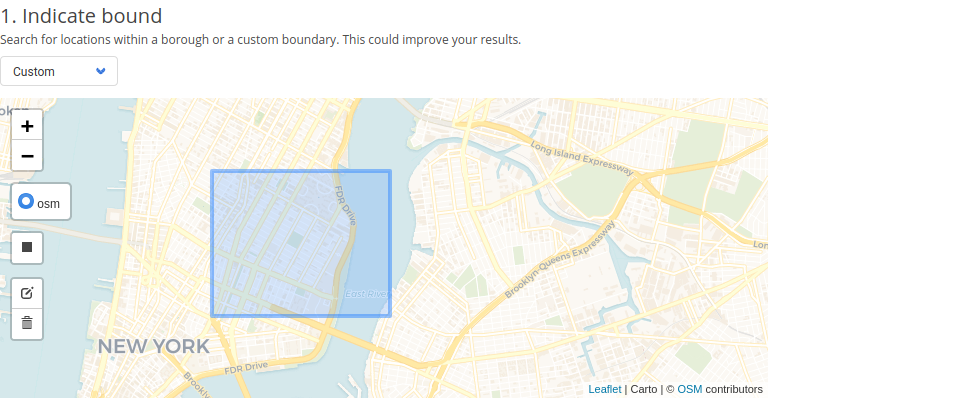
Limit queries to a borough or custom boundary
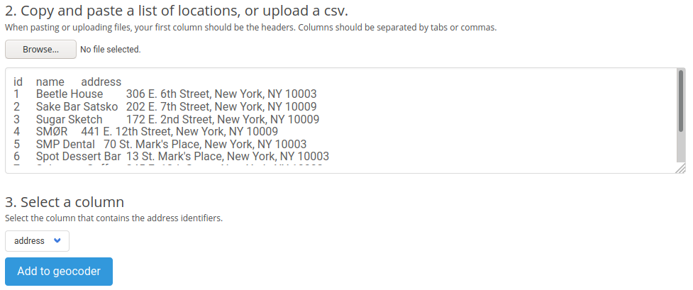
Continuously add entries by pasting or uploading a file
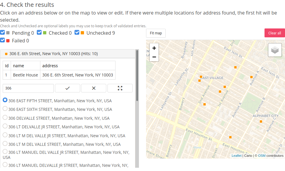
Checking and fixing results
Issues
This tool is currently in Beta and still has some bugs. Below are some known bugs, we are working to fix. Please file a Github Issue if you encounter any others.
- Spreadsheets may not be formatted correctly when pasted (two column spreadsheets has issues, add an additional column as a temporary go-around)
- There is an upper limit of ~5,000 rows before the application will crash or start to lag
Import a spreadsheet with New York City addresses and get latitude and longitude information in a heart-beat.