Overview
Research and Data Assistance Requests (RADARs) are BetaNYC’s Civic Innovation Lab‘s response to the growing need for public interest technology, data, and research assistance. Our team collaborates with partners to help address needs, while also building up your data and analytical skills. The Lab welcomes you to submit requests for research, technology assistance, or support related to open data.
RADAR Services
- Releasing, preparing, and vetting open data
- Geospatial analysis and transformation
- Data analysis and modeling
- Data visualizations
- API development
- User research
- Mobile Application and Website development
Submitting a RADAR

Fill out the RADAR submission form.
Please be sure to include as many details as possible, including your timeline, and your criteria for a successful resolution. Within five business days, we will contact you to refine the project’s scope, ask initial questions, and build an estimated timeline. We engage with clients through a collaborative process that meets your needs and work with you to envision civic data, analysis, visualization, and communication of information in new ways.
Contact lab@beta.nyc, if you have any questions.
RADAR FAQs
What does RADAR stand for?
RADAR stands for Research and Data Assistance Request. RADARs are BetaNYC’s Civic Innovation Lab‘s response to the growing need for public interest technology, data, and research assistance.
What questions can I submit to a RADAR?
We welcome most data and technology questions. No request is too small (although occasionally, a RADAR may be too large, and we will do our best to suggest alternative solutions), and there are no “dumb” questions. Whether you need help locating a dataset, conducting analysis, building a map, or analytical tool, the BetaNYC Civic Innovation Lab is here to help!
Who can submit a RADAR?
RADARs serves the public interest — non-profits, community-based organizations and coalitions, Borough Presidents, Community Boards, City Council Offices, Mayoral Agencies, and media organizations. If you work at one of these, we want to hear from you!
What happens after I submit a RADAR?
Once in our system, a team member from the Lab will respond to you within five days. We evaluate a range of criteria to determine whether we will accept a RADAR, such as:
- Does this request align with BetaNYC’s mission and goals?
- Will addressing this request benefit the public good?
- How much time will it take to complete this work?
- What skills or resources are needed?
- Does a solution or the information for this request already exist somewhere?
BetaNYC seeks to provide accessible research and data assistance services. While we are able to provide some RADAR services on a pro bono basis, this is not possible for all requests. For requests that exceed our team’s current capacity or don’t align with our mission, we do our best to redirect requests to relevant resources and to our network of community allies who have expressed interest or ability.
Upon acceptance of your RADAR, members from the Lab at BetaNYC will work collaboratively with you to address your request through data analysis, visualization, and communication of information in innovative ways.
How did the BetaNYC RADAR service begin?
Since 2019, BetaNYC has worked with the Office of the Manhattan Borough President and NYC Community Boards to address their complex data and analytical needs. This collaboration resulted in the RADAR, an accessible service that we provide to local government offices and community-based organizations to help with one-off data analytics projects. Lab Associates, who are gaining professional experience in our Civic Innovation Lab, work alongside our staff to meet your data needs.
Example RADAR Responses
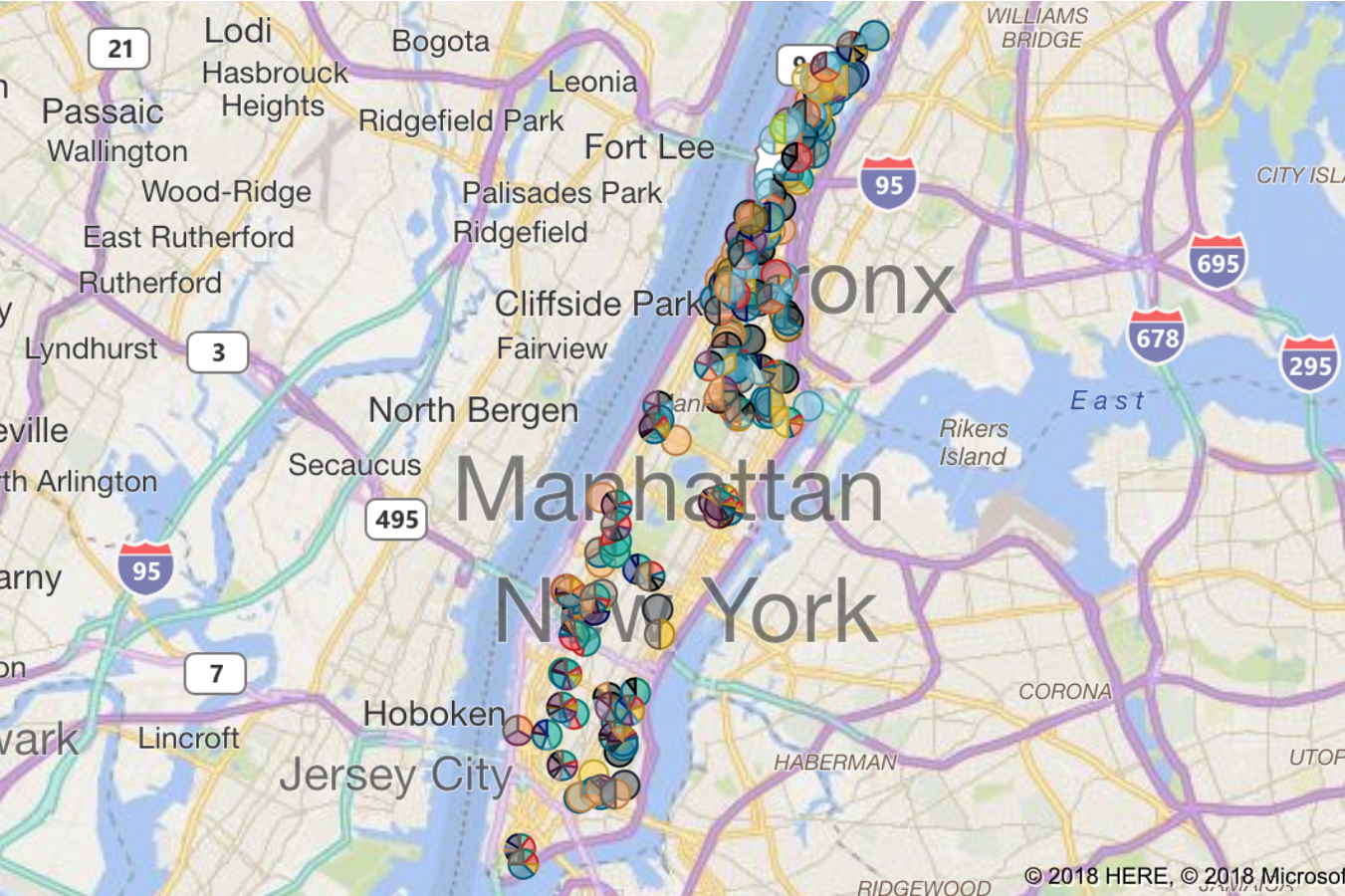
BoardStat
An interactive tool for community boards to discover issues and trends within their district’s boundaries.
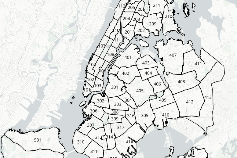
NYC Boundaries Map
A helpful tool for viewing and querying overlapping administrative boundaries in New York City.
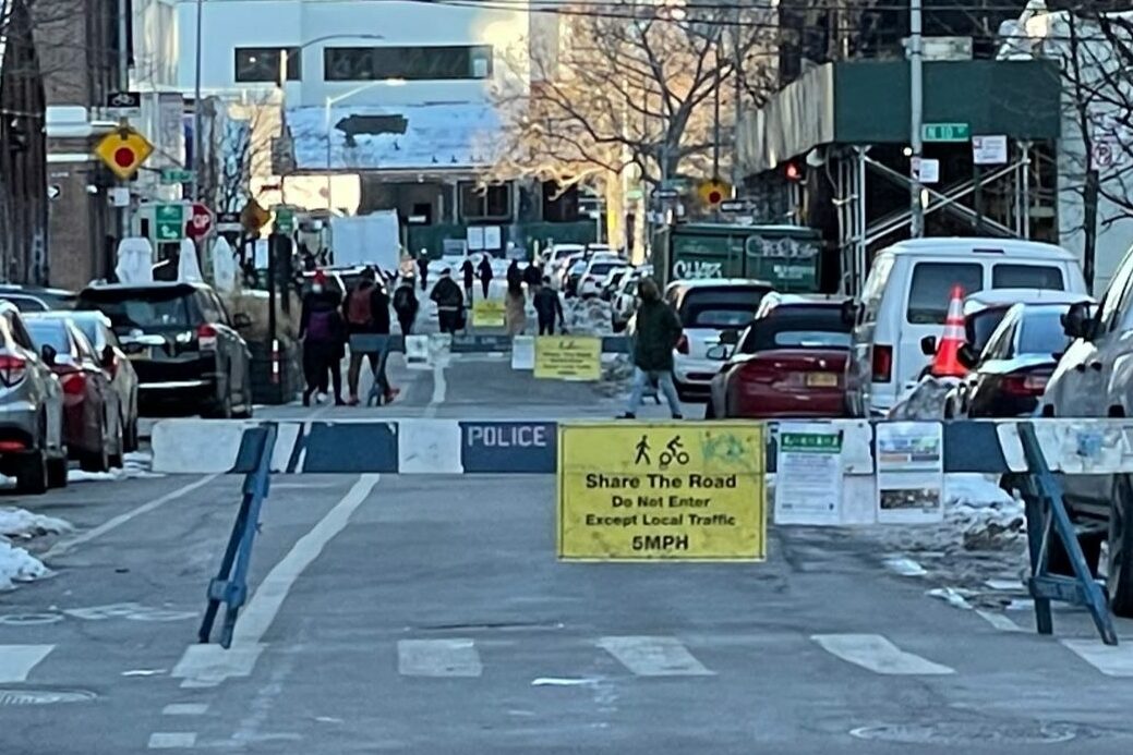
OpenStreets Toolkit
A tool for community partners to manage the logistics of volunteers, time, and communication.